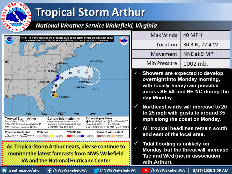
The Tropics: Well this is just what we need...a tropical storm
With all the things going on right now, a tropical storm is the last thing we need to be dealing with.
Especially for the folks on Ocracoke and Hatteras islands.
But that's what we're getting today, as Tropical Storm Arthur - the first cyclone of the 2020 Atlantic Hurricane Season - has arrive.
Arthur's not going to be exceptionally bad, as far as the tropics go, but it's the point. The "official" season isn't supposed to start until June 1. We shouldn't be surprised, though, the season has started early the last five years.
Guess it's a sign of the times.
Arthur currently is just moving parallel to the Gulf Stream just off the North Carolina border, moving to the north-northeast at 15 mph. Its winds are at 45 mph and are expected to hit 50 as the storm skirts the Outer Banks before heading out to sea.
Winds and rain are already pounding northeastern North Carolina.
Forecasters at the National Hurricane Center said that Arthur overnight had tracked slightly west of Saturday's forecast model runs. That could bring it seriously close to The Point sometime Monday afternoon.
All of Dare County remains under a Tropical Storm Warning.
Coupled with an approaching cold front from the west, the region - especially the Outer Banks - could see a total of 4 inches of rain because the front is forecast to stall and bring rain for most of the week.